
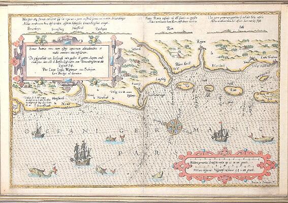


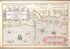
Lucas Jansz Waghenaer (b. Enkhuizen 1534, d. s.p. 1606)
Engraved and hand coloured chart entitled "Situs Iutiae una cum ostijs aquarum alitudinibus et vadis omnium eius insuarlum [...]. Antwerp 1585. Text in latin on verso. C. 40×56 cm. Framed, glass on both sides.
Wagenhaer's map of the region between Boeuebergen and the Isle of Silt, along the west coast of Southern Denmark. Centered on Riypen. Includes sea monsters, sailing ships, compass rose, decorative cartouche, soundings, and anchorages, along with profiles of Silt, Rim, Rijunkopen, Hensburch, Swartsburg and Boeuenbergen.
Minor hole/tear to upper part of middle folding.
Please note: The item is subject to the Anti-Money Laundering Act. In the event of a hammer price of DKK 50,000 or more, including buyer’s premium, the buyer must submit a copy of a valid photo ID and proof of address in order to collect the item.
Books and manuscripts, 12 February 2013
7 bids
| When | Bidder | Bid |
|---|---|---|
| (Auto bid) | ||
| (Auto bid) | ||
| (Auto bid) | ||